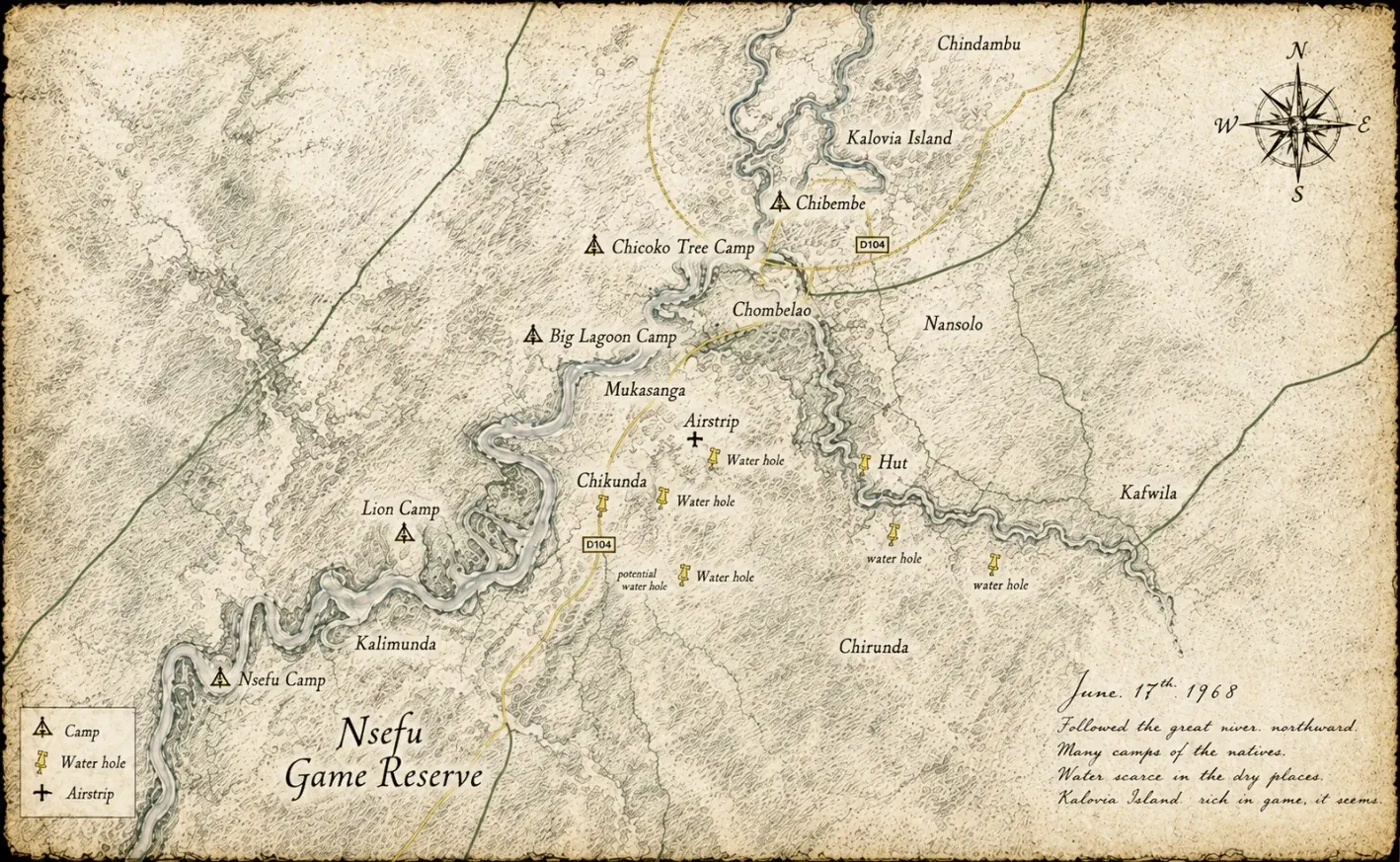
The Luangwa Valley holds a particular place in the story of African wildlife tourism. It is where the walking safari was born, where paying visitors first came to watch game rather than shoot it, and where some of the most important figures in twentieth-century African wildlife work chose to spend their lives. Every chapter of that story turns on the same point on the river: the confluence of the main Luangwa and the Chibembe Channel, where the annual flood backs up and spreads north, renewing every habitat above it.
What follows is drawn from the Northern Rhodesia government’s own annual reports: the Department of Game and Tsetse Control sections, published each year from the late 1940s to the early 1960s. They are dry documents, written by rangers and administrators for administrative purposes. They do not dramatize. They simply record, year by year, what was built, what was opened, how many visitors came and what went wrong. That is exactly why they are among the most reliable sources there are for how photographic tourism began in the Luangwa Valley.
The story ends at Chibembe, on the east bank at the confluence, which became the heart of the Wilderness Trails circuit: the walking safari circuit that defined what South Luangwa would be.
Before tourism: a valley kept wild by its own remoteness
For the first half of the twentieth century, the Luangwa Valley was largely unknown to the outside world. That was not an accident. It was geography.
The valley lies at the southern end of the East African Rift, walled to the west by the Muchinga Escarpment, terrain that made road-building a formidable undertaking. The valley floor was dense woodland and seasonal floodplain, crossed by rivers and cut off for months each year by the rains. The few tracks that existed were impassable for much of the year.
Then there was the tsetse fly. Glossina pallidipes, the dominant species in the valley, carries trypanosomiasis, the disease that kills cattle and causes sleeping sickness in people. It made farming settlement impossible across vast tracts of the valley. The annual reports document, year after year, the government’s struggle to understand and control it.
For the wildlife, the fly was an accidental gift. The conditions that kept cattle and settlement out made the valley a refuge. The elephant herds, the buffalo and the lions thrived precisely because the valley was off limits to the changes that had transformed so much of the continent. The Luangwa was not preserved by decree. It was preserved, in large part, by a fly.
The hunting era
Formal management of wildlife in the valley began not with conservation but with hunting. The early game reserves were set up mainly to manage hunting pressure, and the first organized visitor schemes served hunters.
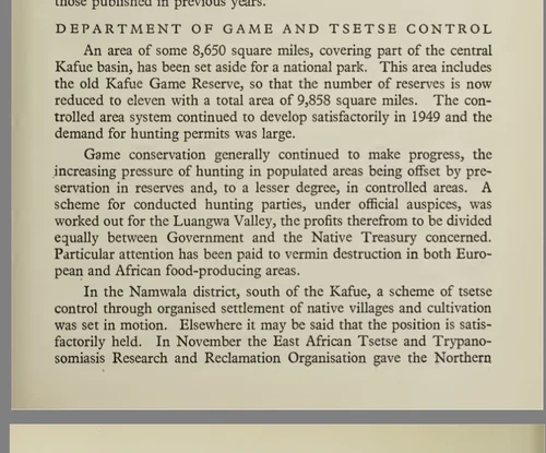
By the late 1940s the Department of Game and Tsetse Control ran a conducted hunting scheme in the Eastern Province, with revenue split between the government and the local Native Treasury.
“A scheme for conducted hunting parties, under official auspices, was worked out for the Luangwa Valley, the profits therefrom to be divided equally between Government and the Native Treasury concerned.”
Northern Rhodesia Annual Report, Department of Game and Tsetse Control, 1949
Photographic tourism, the idea that visitors might pay to watch wildlife rather than shoot it, had not yet arrived.
1950: the experiment that changed everything
In 1950, in the area of Senior Chief Nsefu, something new was tried. A small tourist camp was set up, not for hunters but for game viewers. Chief Nsefu voluntarily prohibited all hunting in the surrounding area. Visitors came, found the wildlife extraordinary, and paid the chief and his council for the privilege. The 1950 report records it in a single matter-of-fact sentence:
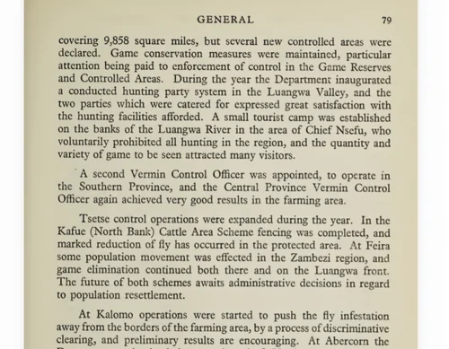
“A small tourist camp was established on the banks of the Luangwa River in the area of Chief Nsefu, who voluntarily prohibited all hunting in the region, and the quantity and variety of game to be seen attracted many visitors.”
Northern Rhodesia Annual Report, Department of Game and Tsetse Control, 1950
This was the first photographic tourist camp in the Luangwa Valley. Game viewed rather than shot. Revenue returned to the community. A chief’s decision to protect rather than harvest. The model that would define South Luangwa for the next seventy years was set out, in outline, in one small camp in 1950.
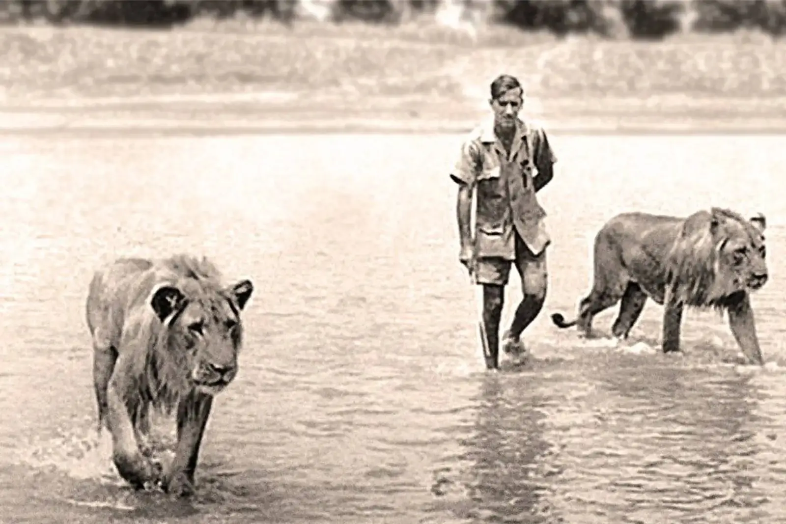
Norman Carr understood earlier than almost anyone in Africa that wildlife survives only when the people living beside it have a real economic reason to protect it, and he put that into practice here, in partnership with Chief Nsefu. The principle is now written into Zambian law and claimed by every responsible safari operator on the continent. In the Luangwa, it was not a theory. It was practiced, and the government recorded it working.
1951: success, and the model spreads
The experiment worked. Within a year the chief’s camp had doubled its visitors, and its success prompted a neighboring chief to follow:
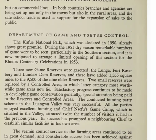
“Chief Nsefu’s Game Camp, which is situated in the Valley, attracted twice the number of visitors it had in the previous year. Its success has prompted a neighbouring Chief to establish similar facilities in his own area.”
Northern Rhodesia Annual Report, Department of Game and Tsetse Control, 1951
The report does not name the neighboring chief.
1954: roads, pontoons and the western bank
In the early 1950s the government began investing seriously in access: not only camps but the roads and river crossings that made reaching them possible at all. By 1954 it had committed to opening the Luangwa South Game Reserve to photographic visitors, starting on the western bank:
“A start was made on an ambitious programme in the Luangwa Valley designed to open up the game reserves of the western bank to the public. A pontoon ferry was installed and linked to this bridgehead, some sixty miles of roads were built in the southern reserve, opening up certain of the better parts of this wonderful game country. The programme envisages the construction of a series of small camps, mostly on the river bank, and there is no doubt that visitors to these will have an opportunity unrivalled in Africa of seeing game in its natural state.”
Northern Rhodesia Annual Report, Department of Game and Tsetse Control, 1954
Read the last line again: “an opportunity unrivalled in Africa of seeing game in its natural state.” It was written not by a safari operator or a travel writer but by a government official in an administrative report. He was not selling anything. He was recording what he saw.
1955: the pontoon at Chibembe
In 1955 the Luangwa Valley Development Unit was formed under Ranger W. E. Poles. Where the 1954 program had focused on the west bank, the Unit turned to the confluence of the Luangwa and the Chibembe Channel, a place of extraordinary wildlife where both channels back up every wet season and flood north.

“A Luangwa Valley Development Unit formed under the command of Ranger W.E. Poles. A seasonal pontoon crossing built across the Luangwa at Chibembe to permit access from the east. Lion Camp and viewing tracks built.”
Luangwa Valley Development Unit record, 1955
Two pieces of infrastructure, on two banks. The pontoon crossed the river at Chibembe, giving visitors who came in from the east access to the country beyond. Lion Camp, with its viewing tracks, was built on the west bank. Both belonged to the same 1955 program, and six years later both would belong to the same walking safari circuit. (The full record is on our Birth Certificate page.)
1956 to 1958: two banks, growing numbers
By 1956 both banks were receiving visitors. The report confirms a permanent camp completed on the west bank and a temporary rest camp kept open on the east, while the Native Authority camps at Nsefu and Luambe had their best year yet.
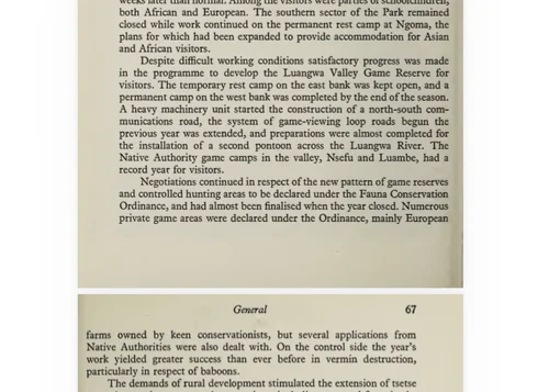
“A temporary rest camp on the east bank was kept open, and a permanent camp on the west bank was completed by the end of the season... The Native Authority game camps in the valley, Nsefu and Luambe, had a record year for visitors.”
Northern Rhodesia Annual Report, 1956
By 1957 the system had real scale: named camps on both banks, visitor numbers, and revenue flowing to local treasuries.
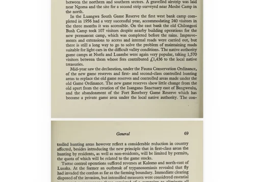
“The first west bank camp completed in 1956 had a very successful year, accommodating 240 visitors in the three months it was accessible. On the east bank the old Chilongozi Bush Camp took 107 visitors... The native authority game camps at Nsefu and Luambe were again very popular, taking 1,570 visitors from them whose fees contributed £1,436 to the local native treasuries.”
Northern Rhodesia Annual Report, 1957
By 1958 Big Lagoon Camp on the east bank was taking 343 visitors, with plans to expand, and a third west bank camp was being designed near Kakumbi.
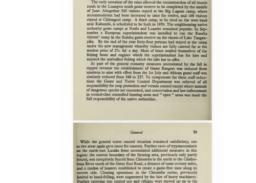
1959: Lion Camp, a government station
By 1959 Lion Camp had become the Game Officer’s Station for the sector, staffed, maintained and improved by the Game Department.
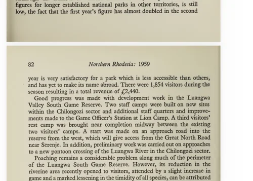
“Additional staff quarters and improvements made to the Game Officer’s Station at Lion Camp.”
Northern Rhodesia Annual Report, 1959
It was the operational hub of the west bank. It was not yet a private walking safari camp. That was two years away.
1960 to 1961: Norman Carr and Wilderness Trails
In 1961, Lion Camp was leased to a private safari company. The valley’s official history, compiled by W. L. Astle from the government record, notes the moment:
“Lion camp leased to ‘Luangwa Safaris’, a director of this company was N.J. Carr; from this camp Wilderness Trails were pioneered by Carr as a type of tourism.”
W. L. Astle, A History of Wildlife Conservation and Management in the mid-Luangwa Valley (1999), entry for 1961
That single sentence records the founding of the walking safari as a type of tourism. And Wilderness Trails was a circuit, not a single camp.
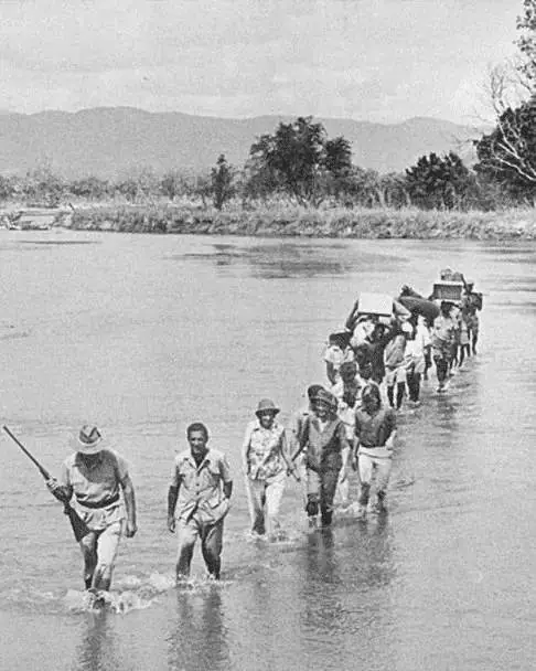
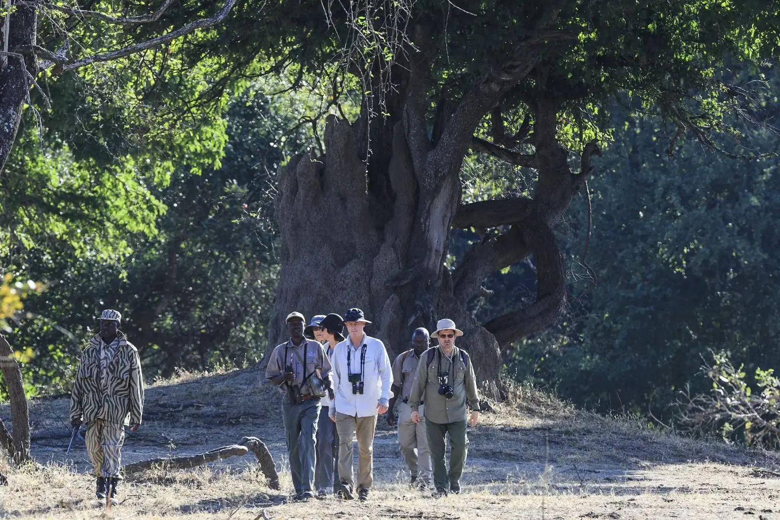
The pontoon at Chibembe had been built “to permit access from the east.” The road came down from Fort Jameson on the east side of the valley, so visitors arrived on the east bank, at Chibembe, where the road stopped and Peter Hankin had built a camp by the crossing. When Carr and Hankin went into business together as Luangwa Safaris, the company came to hold the safari concession across much of the valley, and Hankin’s camp at the end of the road became the launch point for Carr’s walking safaris: the first camp of what became the Wilderness Trails circuit. Carr leased Lion Camp on the west bank: the second, the new frontier the pontoon had opened. Guests crossed from the east, walked the west, and came back, with Chikoko and other bush camps developed as stops along the way. The Chibembe corridor, about nine miles of some of the richest river frontage in Africa, was Wilderness Trails. The east bank at Chibembe is where the road ended and the safari began.
In 1968 Norman Carr formalized the circuit and built Chibembe Safari Camp on the east bank, and the confluence became the circuit’s hub: the camp guides set out from and guests returned to. The name came last. The ground had been the heart of it since 1955.
From Chibembe the walking safari spread. Other guides learned the method, other operators adopted it, and it became the defining activity of South Luangwa and a model for walking safaris across the continent.
The decades after
From 1968, when Carr built Chibembe Safari Camp, the walking circuit ran out of Chibembe through the gazetting of South Luangwa National Park in 1972 and beyond. A generation of Luangwa guides, among them Phil Berry, learned their craft on this circuit, walking out from Chibembe into the floodplains above the confluence.
The circuit followed the valley’s seasons. Chibembe thrived in the dry months, when the flood-renewed country above the confluence held the greatest concentrations of wildlife. For the rains, when the confluence was cut off, Carr set up Chinzombo on the river farther south so walking could continue year-round. As Mfuwe developed, with a bridge over the Luangwa at the main gate and an airport from the mid-1970s, the center of gravity moved south.
In time the circuit came apart. Its camps and concessions were sold separately to other operators. Chibembe, the hub of the original circuit, ran for years as a self-drive campsite, a stop for independent travelers heading north. No walking safaris, no guiding tradition, no circuit. Its heritage lay dormant.
Restoration
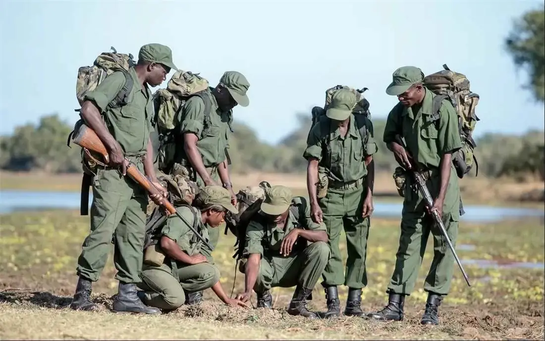
Chibembe was acquired from Wilderness Trails Limited, the company Norman Carr formed in 1975 to run his walking safaris, and its wildlife reserve was re-established on the same east bank ground that the 1955 record names. Scout patrols went out at once. Work with Chieftainess Mwanya began the same week, and so did a borehole drilling program.
After steady presence, investment and trust-building, Chieftainess Mwanya, with Mwanya’s Community Resource Board, granted the lease of Kalovia Island: 2,500 acres of silt-fed country north of the confluence. Chibembe Wildlife Reserve now covers 3,500 unfenced acres. In 2026 it opened to guests again, as part of the Collection, together with Lion Camp across the river, the other end of the original circuit.
The record at a glance
No secondary source, marketing brochure or travel retrospective substitutes for this record. The annual reports say what happened, year by year, in plain language, because they were written for people who needed to know.
Some places matter because of what they are. Others matter because of what happened there. Chibembe is both.
Walk the ground the record describes.
Discover ChibembeSOURCES: Northern Rhodesia Annual Reports, Department of Game and Tsetse Control, 1949–1960 (catalog records b31409830, b31409842, b31409878, b3140988x, b31409891, b31409908, b3140991x, b31409921); W. L. Astle, A History of Wildlife Conservation and Management in the mid-Luangwa Valley, Zambia (1999), entries for 1955 and 1961.